

Google Maps App Will Also Display Forest Fires
Google Maps app, which greatly facilitates our daily life, will now give a forest fire alarm!

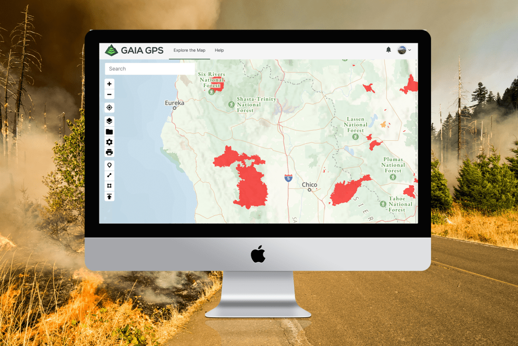
Google's popular map application Google Maps is bringing a new feature to life. Forest fires can now be seen simultaneously on the map.
Google Maps App Did Not Be Silent Anymore
Forest fires, which increase especially in the summer months and cause the destruction of thousands of trees every year, are one of the biggest problems in the world and it is highly likely that we will encounter new fires every year. Especially while the fire threat that caused the death of more than one million living creatures in Australia continued around the world, Google did not remain silent to this problem in the application.
Forest Fires Will be Showed on Google Maps App Simultaneously
The company is incorporating a feature into its application named Google Maps that simultaneously shows the extent of forest fires and where they are progressing. Instant fire information, which will be shared based on data provided by the National Oceanic and Atmospheric Administration's four GOES satellites, will be of vital importance, especially for those whose home is close to the fire zone.
 5 BANKS OFFERING EASY CREDIT OPTIONS
 What Will Happen When You're Be A Software Engineer
 Manipulation Is The Biggest Problem Of The Markets
The data will be updated hourly and the extent of the fire will be revealed on the application. The application, which started in the USA for now, is expected to be used in other countries in the future.
 4 Reasons Why Blogging is Important for Your Business!!!
 Advantages and disadvantages paragraph about being university student;
 Good News From Vuhan, Where The Corona Appeared First: The Last Serious Patient Also Recovered

 Reading Economy News For An Ordinary Person


HABERE YORUM KAT
Türkçe karakter kullanılmayan ve büyük harflerle yazılmış yorumlar onaylanmamaktadır.